
Top 5 Areas in Dubai Requiring Topographic Survey Before Construction
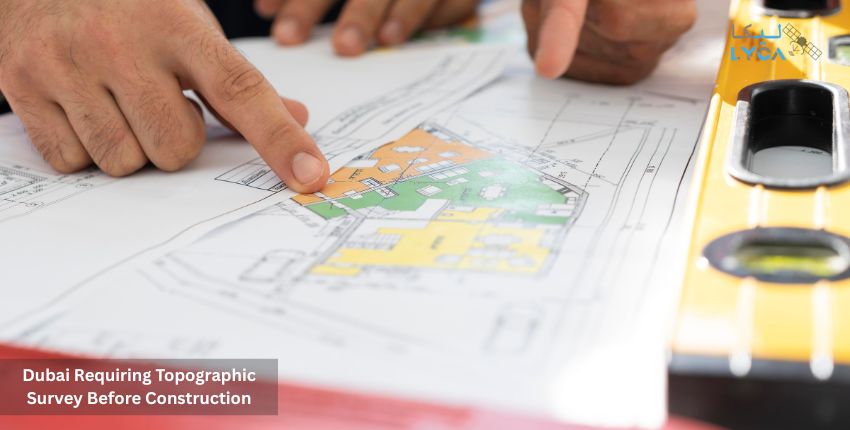
Every construction project begins long before the first brick is laid. Engineers, planners, and contractors depend on accurate land data to avoid delays and costly mistakes. A topographic survey provides this data. It records ground levels, contours, natural features, man-made elements, and underground utilities. Without this baseline, even the most advanced design can fail when tested against real ground conditions.
Dubai presents unique challenges for construction. The city has rapidly expanded onto reclaimed land, filled dunes, and coastal areas. Many of these zones carry risks of soil instability, erosion, or drainage issues. Authorities also require approved survey reports before permits are granted. For this reason, a topographic surveyor in UAE plays a vital role in ensuring projects in Dubai start with accuracy and compliance.
In this article, we highlight the top five areas in Dubai where a topographic survey is essential before any building or infrastructure work begins.
5 Key Areas in Dubai That Need Topographic Survey Before Construction
1. Palm Jumeirah and The World Islands
Palm Jumeirah is among Dubai’s most recognized engineering marvels, with over 560 hectares of reclaimed land supporting villas, hotels, and retail projects. Built using sand dredging and rock placement, the islands remain vulnerable to shifting soil and erosion. This creates a constant need for updated surveys before new construction.
A topographic inspection here helps locate weak soil patches, shifting contours, and underground utilities laid during earlier phases. With continuous development and property upgrades, surveyors must often remap the land to capture new changes. Without this data, designers risk foundation issues or misaligned structures.
The World Islands face similar challenges. Spread over 300 islands, much of the reclaimed land is low-lying, demanding accurate elevation mapping to design drainage and protect against flooding. Surveys allow engineers to understand land settlement rates and plan sustainable building methods.
2. Business Bay
Business Bay is one of Dubai’s largest mixed-use districts, stretching across 64 million square feet. Originally part of Dubai Creek, the area underwent extensive dredging and filling to create a modern business hub. Such reclaimed soil is often variable in compaction, which makes construction challenging.
Topographic surveys in this area document ground levels, canal boundaries, and hidden service lines. Since Business Bay combines waterways, towers, and transport networks, precision is vital. Authorities often demand updated survey data before approving large projects here. By using Advanced Surveying Techniques like GPS and laser scanning, surveyors provide detailed models for developers. This ensures foundations, drainage networks, and access routes are aligned correctly.
3. Jumeirah Lake Towers (JLT)
JLT covers over 730,000 square meters and is built around four artificial lakes. While scenic, such terrain raises engineering risks. Land near water is often soft, uneven, or prone to settlement. A topographic surveyor in UAE maps these changes to help engineers choose safe foundation depths.
Surveys also provide critical information on slopes and water levels. This prevents drainage issues and structural instability. Since JLT is a high-density zone with narrow plots, surveyors also map utilities and access paths to avoid clashes during construction. Projects without this data risk delays due to service line strikes or unstable excavation.
4. Jebel Ali Expansion Zones
Jebel Ali is one of Dubai’s most active industrial and residential zones. With its port, free zones, and new residential clusters, construction here is constant. The ground includes both natural desert terrain and reclaimed land near the coast. In addition, older infrastructure lies beneath many plots.
A detailed topographic survey identifies surface features and buried services. This allows safe excavation and planning. Developers also rely on survey data for grading plans, road layouts, and drainage. Since Jebel Ali projects often involve large industrial sites, the accuracy of topographic surveys directly impacts safety and cost control.
5. Large-Scale Reclamation and Infrastructure Projects
Dubai’s infrastructure expansion shows no signs of slowing. Mega projects like new highways, bridges, and reclaimed developments all demand precise ground data. These projects involve vast tracts of land where minor elevation errors can translate into major design flaws.
Surveyors use Advanced Surveying Techniques such as drone mapping, RTK GPS, and LiDAR to capture fine details over large areas. This produces accurate digital terrain models and contour maps. Such data supports planning for drainage, cut-and-fill balance, and foundation design. Dubai authorities increasingly require survey companies to provide this level of detail before issuing permits.
Why These Zones Demand More Than a Basic Survey
The five areas above share three key risks:
- Unstable soil due to reclamation or proximity to water.
- Flood exposure requiring accurate elevation mapping.
- Regulatory requirements where survey data is mandatory for permits.
Without reliable surveys, projects face cost overruns, safety hazards, and compliance failures. This is why developers rely on trusted topographic survey companies in Dubai to deliver accurate and government-approved reports.
Lyca Survey, Your Expert Survey Partner
At Lyca Survey, we understand the critical role of land data in construction. As a certified topographic surveyor in the UAE, we provide surveys that meet Dubai Municipality and Dubai Land Department requirements.
Our expertise includes:
- Over 250 completed topographic projects across islands, canals, industrial zones, and urban centers.
- Licensed use of Advanced Surveying Techniques, drone mapping, GPS, and laser scanning.
- Full compliance with Dubai regulations and ISO-certified processes.
- Fast turnaround: most reports delivered in under 10 business days.
- Integration of topographic inspection with underground utility checks for complete land data.
Our clients include developers, architects, and contractors who depend on us to reduce risks and build with confidence. Every survey we deliver provides accurate mapping, CAD drawings, and digital models that guide design and construction from the start.
Get in Touch
If you’re planning a project, don’t leave land data to chance. Partner with Lyca Survey, a trusted survey company in Dubai delivering accurate mapping and underground survey services with full compliance. Contact our team today to start your project on a foundation of precision and confidence.
