
2026 Surveying Trends in Dubai: Automation, GIS, Drones & Digital Compliance
Precision sensors, cloud processing, automated analysis, and connected field systems now define how land and structures are measured. These tools support verified records, controlled workflows, and predictable project outcomes. Urban infrastructure depends on accurate spatial data to guide design, construction, and long-term maintenance. In this environment, surveying trends Dubai 2026 reflects a move toward automation, integrated platforms, and digital validation. Modern surveying no longer depends on isolated tools. It operates as a coordinated technical system that supports regulatory, engineering, and operational requirements.
From Manual Fieldwork to Smart Survey Ecosystems
Traditional surveying relied on handwritten notes, manual instruments, and delayed data processing. Today, field teams work within connected digital ecosystems.
GNSS receivers, robotic total stations, and cloud-enabled tablets collect and transmit data instantly. Quality checks happen during fieldwork. Errors are corrected before leaving the site.
This structure reduces rework and improves coordination between surveyors, engineers, and project managers. Surveying trends Dubai 2026 shows that productivity now depends on system integration rather than individual skill alone.
Digital ecosystems also improve safety. Surveyors spend less time in unstable zones. Remote monitoring replaces physical exposure in many cases.
Automation and Robotics in Field Survey Operations
Automation has reshaped daily survey operations. Robotic total stations track targets without manual adjustment. GNSS systems correct positioning through network services. Machine control platforms guide equipment with survey-grade accuracy.
These systems deliver consistent results across large sites.
Automated workflows support:
- Continuous prism tracking
- Remote instrument control
- Automatic calibration checks
- Real-time coordinate validation
Smaller teams can now manage complex projects. Schedules become easier to control. Layout accuracy improves across construction stages.
Automation also supports digital compliance surveying by generating verified logs and instrument records.
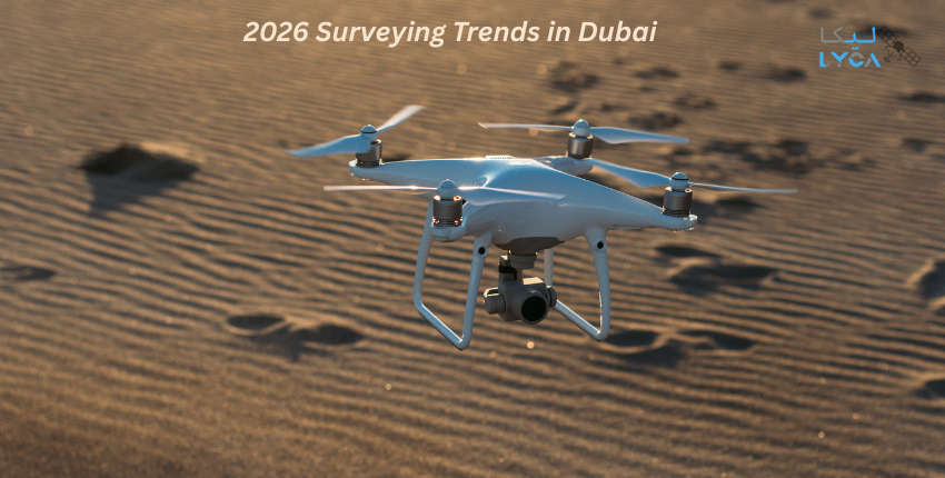
Aerial Drone Mapping and High-Resolution Terrain Models Unmanned aerial systems have become core survey tools. aerial drone mapping Dubai enables fast data collection across wide and restricted areas.
Drones capture overlapping images that convert into elevation models, orthomosaics, and contour maps. These outputs support engineering, planning, and monitoring tasks.
Key applications include:
- Site grading assessment
- Stockpile volume analysis
- Corridor mapping
- Flood and drainage studies
With aerial drone mapping Dubai, survey teams minimize site disruption. Repeated flights provide consistent time-based comparisons.
Modern drones include RTK positioning, terrain following, and automated route planning. These features ensure repeatable survey accuracy.
Reality Capture and Three-Dimensional Site Intelligence
Two-dimensional maps no longer meet modern project needs. Full spatial understanding is now required. This demand is fulfilled through reality capture systems. It combines laser scanning, photogrammetry, and mobile mapping to generate accurate digital twins.
These models record:
- Structural geometry
- Surface conditions
- Clearance zones
- Deformation patterns
Laser scanners collect millions of points per second. Mobile systems capture data along transport routes. Drones fill vertical and inaccessible areas. Through reality capture, teams identify clashes, verify installations, and document existing assets with confidence.
Geospatial AI and Intelligent Data Interpretation
Surveying generates large datasets from drones, scanners, and sensors. Processing this volume manually is inefficient. Geospatial AI transforms raw data into usable intelligence.
AI systems classify terrain, detect changes, and extract features automatically.
Primary applications include:
- Automated boundary detection
- Land-use classification
- Deformation monitoring
- Asset identification
With geospatial AI, processing time reduces significantly. Reports become more consistent. Human error decreases. AI also supports long-term planning. It analyzes historical datasets to reveal trends and risk indicators. As surveying trends Dubai 2026 advances, AI-driven analysis becomes standard practice.
Digital Compliance and Verified Survey Workflows
Regulatory bodies now require transparent and traceable survey records. Digital compliance surveying ensures that every dataset meets technical and legal standards.
Compliance systems manage:
- Calibration certificates
- Field timestamps
- Operator credentials
- Data revision history
These platforms connect field data to approval workflows. Authorities can verify accuracy and origin at any stage. With digital compliance surveying, disputes over boundaries, quantities, and layouts become easier to resolve. Digital records protect both clients and service providers.
Integrated Platforms and Data Interoperability
Modern surveying depends on interoperability. Hardware, software, and analytics tools must function as a unified system.
Integrated platforms enable:
- GNSS, drone, and scanner data fusion
- BIM and GIS synchronization
- Cloud-based collaboration
- Real-time reporting
This structure supports geospatial AI, reality capture, and digital compliance surveying within one workflow. Data moves directly from field collection to design systems. Errors are detected early. Decision cycles shorten. This integration defines advanced surveying trends Dubai 2026 practices.
Professional Surveying Equipment and Technical Capabilities
High-performance equipment remains central to survey accuracy. Professional firms deploy specialized models designed for durability and precision.
RTK GNSS Receivers
- Horizontal accuracy up to ±8 mm
- Vertical accuracy up to ±15 mm
- Multi-constellation tracking
- Built-in cellular modules
Robotic Total Stations
- Angle accuracy from 0.5 to 2 arc seconds
- Reflectorless range up to 1000 meters
- Automatic target recognition
- Tablet-based remote control
UAV Mapping Platforms
- Flight endurance of 35 to 55 minutes
- RTK positioning systems
- High-resolution cameras
- Obstacle avoidance sensors
Terrestrial Laser Scanners
- Scan rate up to 2 million points per second
- Range up to 350 meters
- Registration accuracy ±2 mm
- Integrated imaging systems
These tools support aerial drone mapping Dubai, reality capture, and AI-based processing across project stages.
Applied Use Cases Across Urban Infrastructure
Advanced surveying systems support diverse urban requirements. Transport projects use drones and GNSS for alignment verification. High-rise developments rely on laser scanning for structural checks. Utility networks depend on GIS-linked mapping. Coastal works use terrain models for erosion studies. With geospatial AI, historical data becomes predictive. With digital compliance surveying, documentation remains audit-ready.
Lyca Survey: Advancing Precision Through Technology and Expertise
At Lyca Survey, we integrate advanced tools, certified professionals, and verified workflows into every project. Our operations combine automation, analytics, and compliance within a unified delivery framework.
Our Technical Strengths
- Deployment of RTK GNSS, robotic stations, and UAV systems
- Complete reality capture and 3D modeling services
- Integrated geospatial AI processing workflows
- Certified digital compliance surveying platforms
- Secure cloud-based data management
- Multi-stage quality control systems
Our Equipment Portfolio
We operate professional-grade GNSS receivers with millimeter accuracy. Our drone fleet supports RTK-enabled aerial drone mapping Dubai projects. Our laser scanners deliver dense point clouds for complex analysis. Our processing platforms support large-scale data fusion.Our Operational Commitment
We focus on verified data, transparent reporting, and consistent delivery. Our teams follow standardized workflows from fieldwork to final submission. We invest continuously in training and system upgrades to match surveying trends Dubai 2026.
Partner with Lyca Survey for Reliable Surveying Solutions
Visit our official website to explore how we deliver accurate, compliant, and technology-driven surveying services. At Lyca Survey, we combine experience, advanced systems, and proven processes to support your projects with confidence. Connect with our team today and experience our commitment to precision, reliability, and long-term value.
